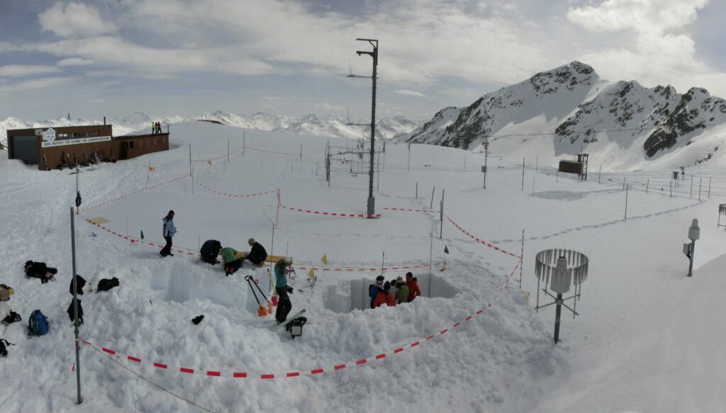
The SnowImager has been tested across a wide range of locations and environments. Field campaigns were conducted in Switzerland (Davos and Jungfraujoch), as well as in Finland, Greenland, and Antarctica. Snow specific surface area and density were derived from these datasets and validated against established reference instruments.
Dome C, Antarctica
Polar snowpacks typically show horizontally strongly inhomogeneous snow layering due to snow redistribution by wind. The SSA retrieval method of the SnowImager provides a useful tool for characterizing the 2D spatial variability of snow at the millimetre to metre scale.
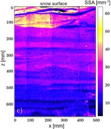
During the Antarctic summer 23/24 a SnowImager has been operated at Dome C station. The figure shows an SSA map of a vertical 0.5 m x 0.7 m snow profile.
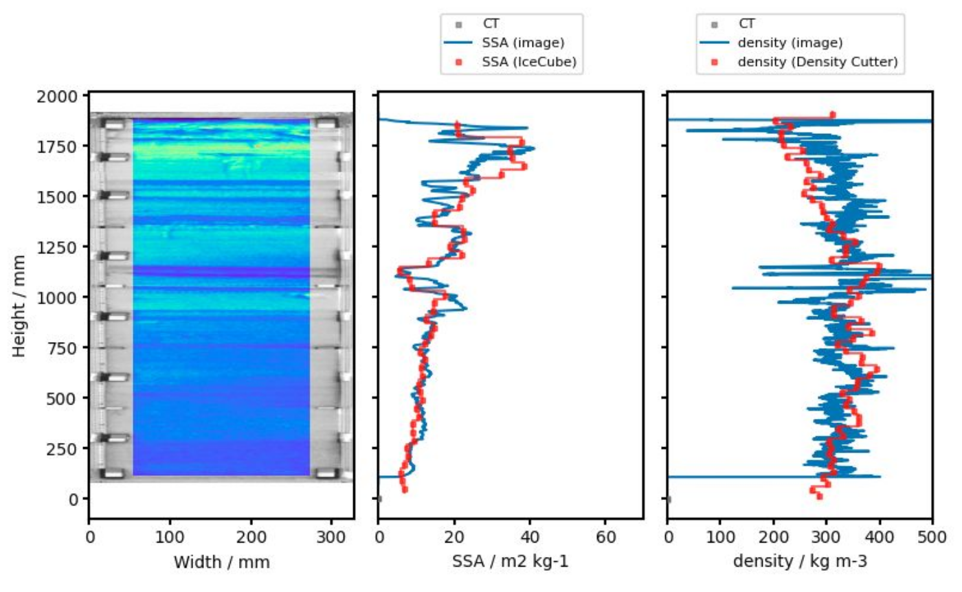
Regular observations took place at the SLF test site in Davos. Comparisons with other instruments show good agreement in SSA (IceCube instrument) and density (density cutter and computed tomography). The figure shows an example of an SSA map (left), an SSA profile (middle), and a density profile (right) with reference values.
Sodankylä, Finland
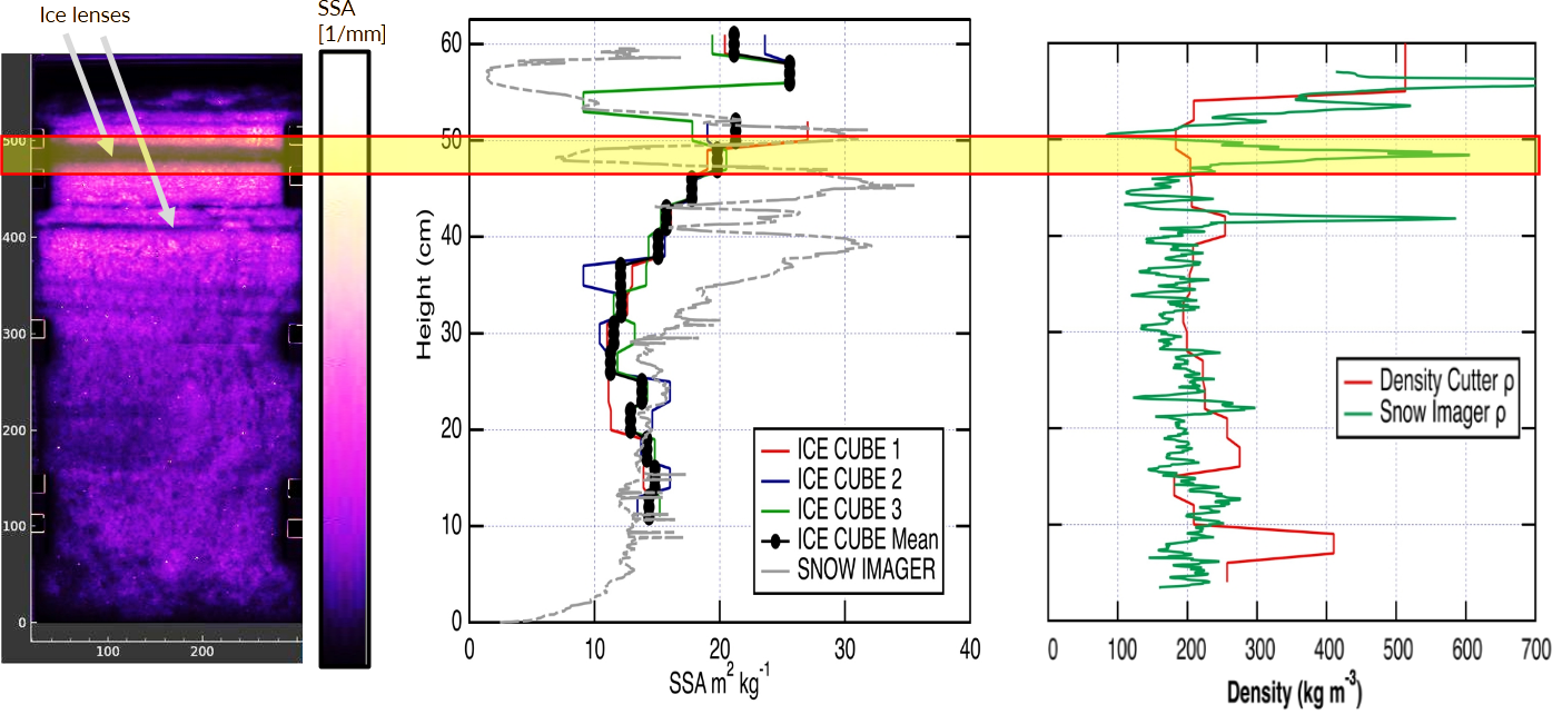
These measurements were conducted in February 2024. The example includes several ice layers, which are very thin structures that many other field instruments are unable to resolve. The figure presents an SSA map along with the corresponding SSA and density profiles, compared to measurements obtained with other methods and instruments. The SnowImager is capable of resolving low-SSA, high-density ice layers that are only a few millimetres to one centimetre thick, unlike the density cutter and the IceCube instruments.